TAMPA, Fla. — Watch 10 Tampa Bay and scroll below for the latest updates on Invest 97L from WTSP's team of meteorologists:
August 1st - 2:00 PM Update:
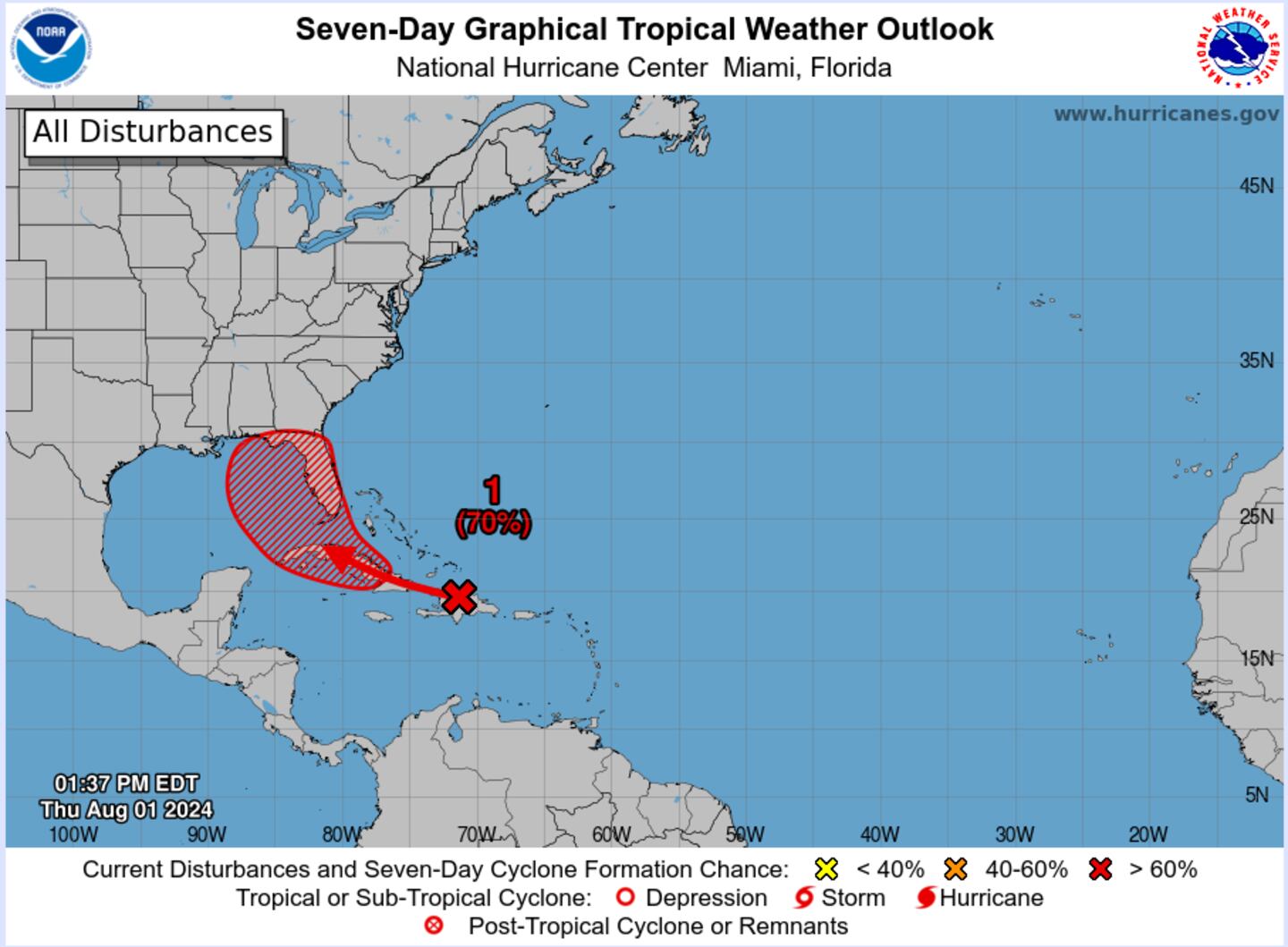
Southwestern Atlantic and Eastern Gulf of Mexico (AL97):A well-defined tropical wave is producing a large area of disorganized showers and thunderstorms over Hispaniola, Puerto Rico, the Southeastern Bahamas, and the adjacent waters of the southwestern Atlantic and northeastern Caribbean Sea. Development of this system should be slow to occur during the next day or so while it moves west-northwestward over portions of the Greater Antilles. However, environmental conditions are forecast to be more conducive for development after the wave passes the Greater Antilles, and a tropical depression is likely to form this weekend or early next week over the eastern Gulf of Mexico near the Florida Peninsula. Interests across the Greater Antilles, the Bahamas, and Florida should continue to monitor the progress of this system.* Formation chance through 48 hours...low...30 percent.* Formation chance through 7 days...high...70 percent.